Course Map
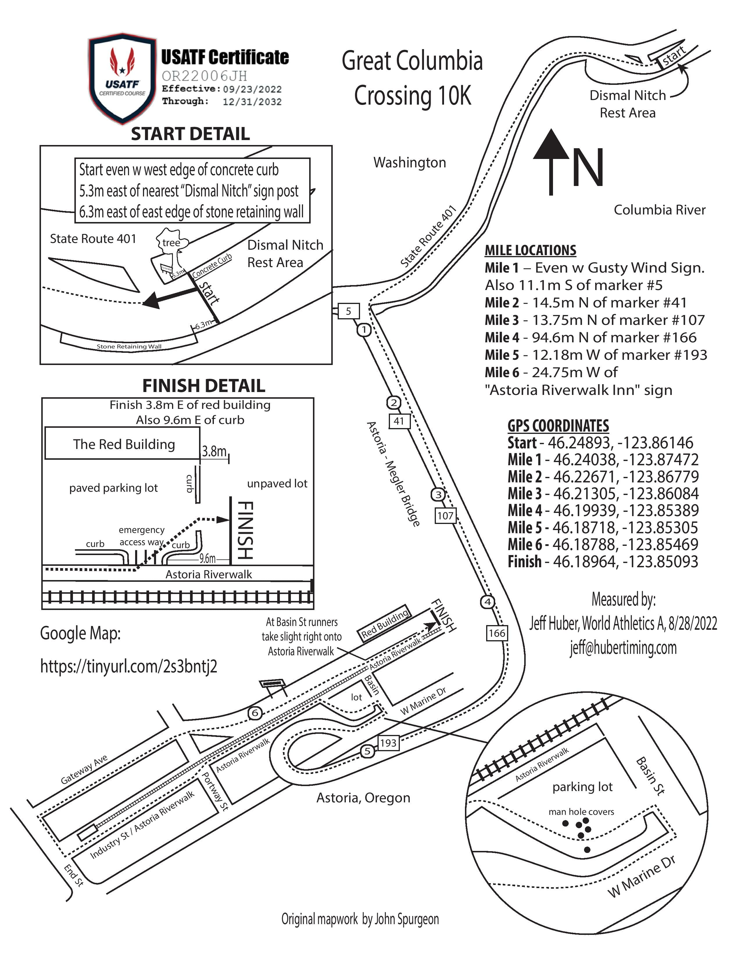
Participants start at Dismal Nitch Rest Area in Washington. They head southwest on State Route 401 toward US-101/Oregon Coast Hwy. Participants turn left onto US-101/Oregon Coast Hwy, cross the Astoria-Megler Bridge and make a left onto US-101/W Marine Drive. They turn left and head through the parking lot near Basin Street and follow arrows west to the Riverwalk. Participants stay on the Riverwalk and then turn right onto Hamburg Street, right on Gateway and then go straight to the Finish Line at the foot of Basin Street!
The Astoria-Megler Bridge is only open to participants from the race start at 8:45 a.m. until 10:45 a.m. This means participants have roughly two hours to travel about 5.2 miles of the 6.2-mile race course, as the final mile of the event takes place on city streets after exiting the bridge.
If you cannot cross the bridge within the two hour time limit, you will be picked-up by a “sweeper bus" at 10:45 a.m. This is necessary to ensure the bridge can reopen to vehicle traffic promptly at 11 a.m. The finish line will stay in place until 11:30 a.m. All participants MUST finish the event course by that time.
Those who sign up for this event should be able to sustain a walking pace of 3 mph (1 mile in 20 minutes) for the duration of the course.
The uphill portion of the bridge is a little more than 3,250 feet, which is about .61 of a mile. The hill starts about 3.9 miles into the race. The bridge crest is about 4.5 miles into the race. The grade of the hill is 5.62%, or a little less than a 4° slope.

